
Physical Landscape
|
This is the Pacaya Volcano in Guatemala. It is about 19 miles north of the capital; Guatemala City, Guatemala. The volcano stands about a mile and a half high and is still active to this day! The eruptions are usually visible from Guatemala City.
URL: http://www.authenticmaya.com/images/volcan_pacaya13806%20(3).JPG |
 Physical Landscape
This is the Cloud Forest in Guatemala. This forest is very moist, has a lot of vegetation including moss covering the ground, and consistently has an overcast of clouds at the canopy level.
URL: http://www.authenticmaya.com/images/Bosque%20nunoso.jpg
URL: http://www.authenticmaya.com/images/Bosque%20nunoso.jpg
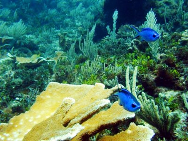
Physical Landscape
|
These are the coral reefs off of the Caribbean Coast of Guatemala! They are not as colorful as other coral reefs but they are still amazing and beautiful. There are many different wild life and plant life that live in the coral reefs.
URL: http://www.authenticmaya.com/images/amatique2.jpg |
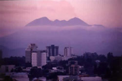 Human Landscape
This is a picture of the sunset on Guatemala City with the Pacaya volcano in the back ground. Guatemala City is the capitol and is the most populated city in Central America. Guatemala City is also known as Guate and is located in the south-central part of Guatemala.
URL: http://www.authenticmaya.com/images/549.jpg
URL: http://www.authenticmaya.com/images/549.jpg
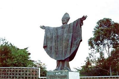
Human Landscape
|
This is the monument to John Paul II also known as John Paul the great. He was the Pope from 1978 to 2005! This monument is located in Guatemala City. URL: http://www.authenticmaya.com/images/juanpabloiimonu.jpg |
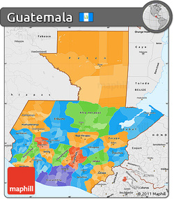 Cultural Regions
This is a map of the borders of the Republic of Guatemala whose official language is Spanish. Guatemala is 42,042 square miles and has a population of 15,438,384!
URL: http://maps.maphill.com/guatemala/simple-maps/political-map/single-color-outside/borders-labels/free-fancy-political-simple-map-of-guatemala-single-color-outside-borders-labels.jpg
URL: http://maps.maphill.com/guatemala/simple-maps/political-map/single-color-outside/borders-labels/free-fancy-political-simple-map-of-guatemala-single-color-outside-borders-labels.jpg
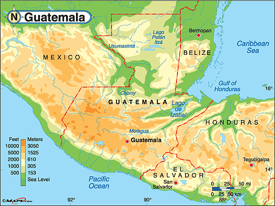
Physical Region
|
This is an elevation map of Guatemala. In the southern Guatemala it is very high in elevation except near the ocean and in the north it is very low in elevation.
URL: http://media.maps.com/magellan/Images/guatemalarah.gif |
 Physical Region
This is a climograph of Guatemala all year around. As you can see it can get very hot and very moist during the summer. On the first graph the red dots are the maximum temperature while the yellow dots are the minimum temperature. The bottom blue bars are the average rain fall.
URL: http://www.rainbowtours.co.uk/upload-files/resource/11%20Weather%20Guatemala.jpg
URL: http://www.rainbowtours.co.uk/upload-files/resource/11%20Weather%20Guatemala.jpg
